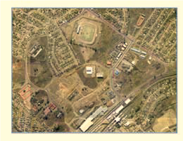
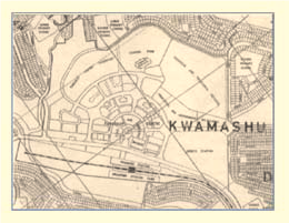
ABOUT KWAMASHU
History
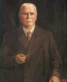
It refers to Sir Marshall Campbell (1848-1917) the sugar cane farmer and magnate who owned the land on which KwaMashu stands and who was a member of the Legislative Assembly of the Natal colony (now KwaZulu Natal).
Marshall was the father of the late Dr Killie Campbell (Margaret Roach Killie Campbell), who had a close relationship with the Zulus living in KwaMashu. The area was successively administered by the Durban City Council and the Port Natal Administration Board and, on 1 April 1977, was transferred to the authority of the newly defined KwaZulu government.

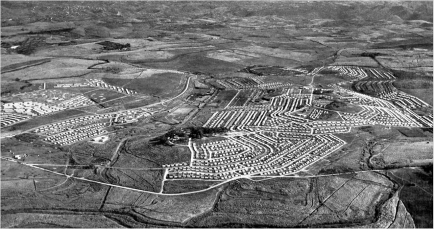
KwaMashu is a township situated 25km north of the Durban city centre. It was established in the period 1955–1966 to house black people forcibly removed from Cato Manor. Housing consists of either standard township-style housing or informal wellings. The present population is about 180 000. KwaMashu was located on state land that was subsequently devolved to the eThekwini municipality. It is part of the area known as INK (Inanda-Ntuzuma-KwaMashu).
The development of KwaMashu Township, in the KwaZulu-Natal province resulted from the mass resettlement of the slum population of Cato Manor during the period of 1958 to 1965.
KwaMashu is one of the first of Durban’s townships that emerged with the implementation of the Apartheid Group Areas Act during the 1950s. The Group Areas Act was a system used by the Apartheid government to physically separate Indians, Coloureds and Africans who lived collectively in places such as Umkhumbane (Cato Manor ) an Indian township in Durban , Sophiatown in Johannesburg and District Six in Cape Town. KwaMashu became home to many of the people who were displaced through the implementation of the Act.
Durban’s rapid population growth in the 1950s intensified pressure on the Durban City Council (DCC) from the White population to clear Durban of its slum areas for security purposes and segregate urban areas. The Council was now compelled to take action on the housing of the African population of the city. Subsequently, in 1952, an emergency camp at Cato Manor was erected on a “site and service” basis in an attempt to ease the situation.
This was followed by a period of prolonged negotiation and planning for the purchase of land and the building of the KwaMashu township. The Durban City Council was required to submit their strategies to the central government for authorization. The Council was not only expected to ensure that 10 000 Indians were removed from the Duff's Road village, which fell within the boundaries of the new proposed township, but it also had to place buffer zones between African and Indian neighbourhoods and make certain that there were no connecting roads between them.
KwaMashu township was first proposed in 1948 and finally, in June 1956, a final agreement of sale was approved by all parties at the price of £350 000 bringing to fruition the Council’s long-standing pronouncement concerning the displacement of Durban’s African residents to the north of the city. Plans for KwaMashu Township were presented to the Cato Manor Native Advisory Board for approval. Cato Manor residents who were considered illegitimate were never invited to give any input to the policy or planning of the township designated for them.
Construction of KwaMashu began in September 1957 and in November the Council started to systematically remove Africans from Cato Manor. Furthermore, 36 000 circulars were distributed in Cato Manor extolling the virtues of home-ownership, and industries were contacted and asked if they would assist in the removal of their employees.
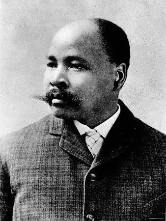
In a competition held by The Daily News newspaper to find a proper name for the township, the name KwaMashu was suggested. This name was strongly opposed by the Native Advisory Board in Durban who favoured the names Mahlatanyane (after A.W.G. Champion - Mahlati) or Mafukezela (afterJohn Langalibalele Dube).
Houses in KwaMashu were erected in phases and occupied by Black people from March 1958.
By February 1962, the population of KwaMashu had reached 40 000 people, and the number rose even further when many Blacks were removed from other city locations (particularly Baumanville) to the area. In 1973, the Port Natal Bantu Affairs Administration Board took over control of KwaMashu.
The clearing of Cato Manor and the re-settlement of its inhabitants at KwaMashu was a process of great upheaval for many. The number of Blacks who disappeared during the course of the removals, estimated at 20% of the population of Cato Manor (30 000 to 40 000 people), is an indication of the number of Blacks who lived at Cato Manor without rights to urban residences. Some of these people may have vanished in order to escape resettlement at KwaMashu.
For those who moved to KwaMashu it meant increased travelling costs and inconvenience in terms of commuting to work and costly accommodation. KwaMashu has an area of 21.47km squared, with Zulu males being the predomininate gender!
KwaMashu is divided into several sections, each denoted by a letter of the alphabet, like A, B, C, and so on according to a report from the Institute of Current World Affairs. Additionally, there are informal settlements and transit camps in the area, like Siyanda A, B, and B5. Some residents of Ntuzuma, a neighboring area, feel that Ntuzuma requires its own focus, even though it's generally considered part of KwaMashu
Origins of The Town Centre Project
The restructuring of local government in South Africa began in the mid-1990s. A number of smaller local councils in the greater Durban area were amalgamated into a single metropolitan municipality, and the boundaries of the city were expanded to incorporate a number of new areas.The department responsible for economic development at the time started to look for a suitable location for a focused, municipality-led intervention in the newly incorporated areas.
The political violence of the 1980s had been particularly intense in the northern areas. As a result, development in those areas had been impeded, and there was a greater level of need. In 1998, a pre-planning assessment concluded that the greatest positive economic impact could be achieved by focusing on the development of one centre in the newly incorporated northern areas – namely the KwaMashu Town Centre.
- It was already a busy transportation hub for train, bus and taxi commuters. This meant there were already large numbers of people in a highly accessible location.
- It had a large area of well-located, undeveloped land owned by the state that had been set aside for a town centre. This land had potential for future development at a time when there was strong private-sector interest in township investment opportunities.
- There were already a number of spontaneous trading activities clustered in the area, some of them formal.
- This meant that attempts to support and stimulate business stood a good chance of success.
- The community living around the town centre had relatively high income levels and there were many home-based
businesses, from professional services to backyard trades. - This suggested there would be a good foundation for commercial success
R293 townships were proclaimed in the former homelands under Regulation 293 of 1962. They were characterised by a general plan and surveyed stands, but with lower levels of infrastructure and services than in other proclaimed towns, and with less stringently applied zoning restrictions. Residents in such townships held land in the form of deeds of grant, or leased properties from grant holders.2 The land was deemed to be owned by the eThekwini Municipality in terms of an agreement with the Department of Provincial and Local Government.
Context at project commencement
The township administration had virtually collapsed. KwaMashu was an R293 township1 of the former ‘homeland’ of KwaZulu that had been incorporated into Durban after the advent of democracy in 1994.
Newly incorporated areas like KwaMashu fell outside city policy and strategic planning frameworks, and the administration was not functional. The eThekwini integrated development plan provided some guidance, but only at a strategic policy level. There was a lack of good information on population, property, income and socioeconomic trends.
There were some 10ha of vacant land in the town centre owned by the state and devolved to the municipality.2 There was no private ownership of land – some 25 per cent of the land was held in terms of deeds of grant, which in effect are longterm
leases. The lack of private ownership provided a strong disincentive for property improvement of any kind.
| Country | South Africa |
|---|---|
| Province | KwaZulu-Natal |
| Municipality | eThekwini |
| Main Place | Durban |
| Established | 1959 |
| Area | |
| • Total | 21.47 km2 (8.29 sq mi) |
| Population (2011) | |
| • Total | 175,663 |
| • Density | 8,200/km2 (21,000/sq mi) |
| Racial makeup (2011) | |
| • Black African | 98.8% |
| • Coloured | 0.2% |
| • Indian/Asian | 0.8% |
| • White | 0.1% |
| • Other | 0.1% |
| First languages (2011) | |
| • Zulu | 91.3% |
| • English | 2.9% |
| • Xhosa | 1.5% |
| • S. Ndebele | 1.3% |
| • Other | 3.0% |
| Time zone | UTC+2 (SAST) |
| Postal code (street) | 4360 |
| Area code | 031 |
Overview
KwaMashu is divided into ten wards and is adjacent to the Ntuzuma and Inanda areas. These areas according to the eThekwini Municipality are known as INK (Inanda, Ntuzuma and Kwa Mashu).
The first clinic, established in 1962, is known as the Poly Clinic, which provides all the services because there is also an HIV / Aids center called Nqobani Clinic. Transportation in Mashu includes, taxis, buses and trains. Many football stars, politicians, theater players were born in Kwa Mashu. There is a shopping center in the area called Bridge City Shopping Center and Kwa Mashu Shopping Center. KwaMashu is home to the ‘Ekhaya Multi Art Center’ and has a community station Vibe 94.7. There's also KwaMashu Sport Center for all indoor sports activites.
According to recent statistics released by Lightstone, 41 property transfers have taken place over the past year. All of the sales concluded were freehold properties and priced at under R400 000. Interestingly, 46.51% of recent purchasers in the area fell in the age group of 18-35 years of age; perhaps an indication that affordably-priced properties prove attractive to those in the younger age groups. This may, in part, be due to the excellent public transport system that is in place, attracting up-and-coming professionals to settle in the area. Price averages have maintained steady growth over the last five years; however sales volumes have declined somewhat over the same period.
There are a total of 23 schools, both primary and secondary, to choose from when considering the educational needs of the children living in the area. A number of large shopping centres such as the Kenmore or the Phoenix Plaza cater for the needs and wants of those who reside here.

AI Content Analysis
This content has been analyzed for AI generation:
- AI Probability: 0%
- Confidence:
- Last Checked: January 20, 2026